top of page
Fast Deliveries
Expert Advice
Technical support


How to improve the accuracy of your utility mapping and asset management
Discover how to enhance utility mapping and asset management accuracy with GeoMax Zenith06 Pro, Samsung XCover 7 and X-PAD ultimate software
3 min read


How to use laser scanning spheres
Discover how to use laser scanning spheres for precise 3D surveys. Learn to align scans accurately and enhance your workflow with laser scanning spheres.
2 min read


Overcoming Common GNSS Challenges in Land Surveying
Discover how to overcome common GNSS challenges in land surveying, from signal blockages and multipath errors to low network coverage. Learn how to minimise them with GeoMax Zenith60 Pro, Zenith55, and ProNet correction service.
2 min read


Workflow Bottlenecks Archaeologists Face in the Field — and How to Fix Them
Archaeologists face daily workflow challenges in the field, from slow data collection to disconnected teams. Discover how X-PAD Ultimate and X-PAD 365 help archaeologists save time, improve collaboration, and streamline site recording with intuitive tools built for real-world excavation.
3 min read


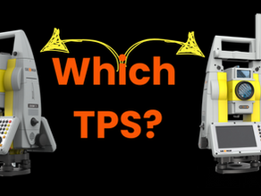
How to Choose the Right Robotic Total Station: Zoom75 vs Zoom95
When it comes to robotic total stations, precision, reliability and efficiency are key. Whether you're upgrading from a manual instrument...
2 min read


Solving Your Field-to-Office Data Transfer Challenge with X-PAD 365
One of the biggest challenges land surveyors and setting-out engineers face is transferring data between the field and the office.
3 min read


How to choose your field controller?
Choosing the right field controller boosts productivity & reliability. The Zenius08 & UT12P suit diverse needs for surveyors.
3 min read


Advanced GNSS technology cut surveying time in half
GPS receivers are nothing new but the latest advancements in GNSS (Global Navigation Satellite System) technology, significantly reduce
2 min read


Top Surveying Solutions for Handling Difficult Terrain, Weather Extremes and Regulatory Challenges
Land surveyors and construction professionals often face challenges such as difficult terrain, adverse weather conditions, and complex...
2 min read


Integrating X-PAD Ultimate and Laser Scanners for Precise 3D BIM Models
BIM relies on collecting accurate geospatial data from topographical surveys, existing site conditions, and precise measurements of land...
2 min read


Enhancing Surveying Efficiency with GeoMax Zoom95 and X-PAD Software
Poor radio frequency often leads to interruptions and delays, impacting overall productivity and accuracy. To address these issues,
2 min read


What is BIM and how does it impact measured building surveyors?
The introduction of Building Information Modeling (BIM), coupled with advancements in surveying equipment and digital tools, has unlocked
2 min read


How to choose your GNSS Antenna
Global Navigation Satellite System (GNSS) technology has become an integral part of modern land surveying and construction projects.
2 min read


GeoMax X-PAD Ultimate Software: compatible with Android
GeoMax X-PAD Ultimate Software with user-friendly design and compatible with most Android devices. Land surveyors choose your modules.
2 min read


Top 10 Benefits of Hiring Land Surveying Equipment
Top 10 Benefits of Hiring Land Surveying Equipment for land surveyors and construction surveying. Cost saving, flexible, try before you buy
2 min read


The Role of Terrestrial Laser Scanning & Mobile Laser Scanning for Land Surveying & Construction
Importance of terrestrial laser scanning & mobile laser scanning for Land surveyors, civil engineers, and construction ground workers
2 min read


GPS vs. GNSS: Understanding the Key Differences and Their Importance for Land Surveyors
Differences between GPS & GNSS: Uncover their differences and why they're vital for land surveyors, enhancing accuracy and efficiency
2 min read


PRO GEO Survey Ltd Earns Authorised FARO Dealer Status
PRO GEO achieved authorised dealer status with FARO Technologies, a global leader in 3D measurement and imaging solutions
1 min read


Exploring the Future of Reality Capture with the FARO Focus Premium 3D Laser Scanner
Explore FARO Focus Premium's revolutionary impact on land surveying—unmatched precision, topographic mapping, and construction documentation
3 min read


12 key ways to use your Zone20 laser rotator
Laser rotators are the perfect tool for levelling, alignment, and measurement tasks in the construction industry. 12 Ways to use your Zone20
2 min read
bottom of page


